Tangible Landscape
Wednesday, January 20, 2016
Discovered a new project today that will be of interest to AR Sandbox folk: Tangible Landscape – “a collaborative modeling environment for analysis of terrain changes. We couple a scanner, projector and a physical 3D model with GRASS GIS. We can analyze the impact of terrain changes by capturing the changes on the model, bringing them into the GIS, performing desired analysis or simulation and projecting the results back on the model.”
— https://geospatial.ncsu.edu/osgeorel/tangible-landscape.html
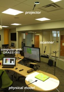
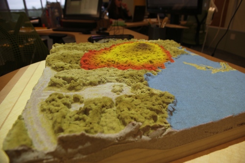
The physical setup is similar to AR Sandbox — computer, depth camera, projector, modelling surface — but not as integrated. One of their approaches on the model side that piqued my interest is using a physical 3D model as a substrate and then sand impregnated with a polymer on top for malleability.
From watching the videos, AR Sandbox kicks butt in terms of interactivity, with near real-time responsiveness, while Tangible has the high ground (heheh) on real world data integration and analysis.
I’m looking forward to seeing how these two projects can inform each other and build greater things.
From <http://lakeviz.org/forums/topic/tangible-landscape/>