Sketch Map of Alaska
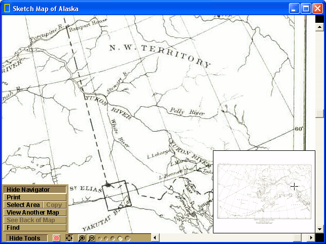
Sketch Map of Alaska is one of the smallest maps from the National Geographic map set. The compressed attached UAK191E1.@EX is 545kb. Image below is zoom level 4, focused on the canadian part of the Yukon River, using the NG map viewer.
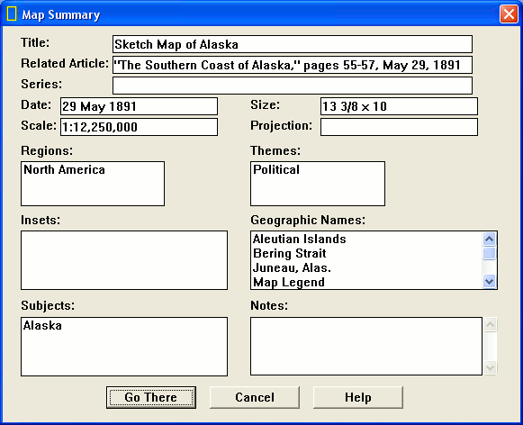
Corresponding entry from my reconstructed mapdb (more on that later):
<map>
    <title>Sketch Map of Alaska</title>
    <file>UAK191E1</file>
    <features>
    125Map LegendJuneau, Alas.Sitka, Alas.Pt. BarrowBering StraitYukon RiverYakutat BayAleutian Islands35543351533122342221241311211211</features>
    <size>13 3/8 x 10</size>
</map>
And this is how it looks in the NG app. Obviusly there is another table beside the one I've reconstructed to pull info from. I've not attempted to reconstruct that one yet.
Pyramids#
Derived from screen dumps of each zoom level:
Level 1: 226 x 183 Level 2: 452 x 336 Level 3: 904 x 733 Level 4: 1810 x 1466
Picdumper.py extracts 339 images from this map while Jpeg Extracter pulls out 341. There are 341 occurences of 'JFIF' in the filtered text version: UAK191E1-filtered-text.txt
This info combined with levels shown in ngviewer and the multiple image headers (pic2, jfif, pic) leads me to think this format might be using jpeg tiles arranged in pic2 layers. Not sure yet what to think about the PIC parts.
date: 2009-12-15
tags: [projects]
category: Projects/ExeComp_Binary_EX_File_v2